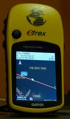
What's the difference between OSM on Garmin and Garmin City Navigator?
(I was asked this on a bike forum, and it's worth putting out wider)OpenStreetMap is a wiki world map, so it's like Wikipedia: lots of detail in some places, and some gaps. In general all the useful roads are in place - I've no trouble navigating around using it - but villages may be just dots.
When some enterprising mapper decides to put the detail in, it can be better than the commercial maps: fresh areas are
really fresh, and micro-mapping nerds (the equivalent of fanboys writing about Firefly on wikipedia) get buckets of detail in. OSM in the UK and Germany is very comprehensive; Northern Europe is pretty good, so's the US.
OSM's coverage of third-world locations is often better than any commercial map, because there's no money in updating a map of Kinshasa, but a UN intern with a hiking GPS can lay out the groundwork in a weekend. There was a recent project to update Gaza, which was ever so cool.
City Navigator is
very strong on POI - points of interest, pubs and cinemas and so on. OSM's POI are a bit variable. POI weren't the original aim of the project, which has grown way outside its original scope (it was never intended to be on Garmins!). Now, people are filling in POI and it's fleshing out well.
Routing on OSM is fairly new. Sometimes people have mapped an area a bit weirdly, and the routing can go a little mental, but mappers are tidying those up now that routing is maturing. City Navigator's routing is good, but like all GPS routing, if you set it wrong on the device, you can end up in a pond.
One thing I really like is that updates to OSM get included quickly. The cost of updating Garmin maps means that I know plenty of people still using a map several years old; OSM is as fresh as last night's edits. (User edits hit the live map in a couple of hours; most extracts like the ones I use are once-per-day).
As for my take on the map, it's a heavyweight, busy one aimed at cyclists and hikers: it's got contour lines, and trail/cyclepath obstructions like fords and gates, and cafes and convenience stores and pharmacies and bike shops, for example. I've added highway points like crossings, lights and mini-roundabouts for walking navigation. Bus stops and postboxes are also included, mostly because if they show up, you know someone has obsessively covered the area in detail ;)
My map is pretty cluttered and busy at some zoom levels. 300m in a city is ugly. It's best at 80-120m and 1-3km, which I think are best for walking and riding. Works fine elsewhere, but it's got lots of thick friendly lines.
In summary: Garmin City Navigator has proven routing and great POI, but costs a lot and updates infrequently. OSM has routing, rapid updates, contour lines, and is free, but has the inherent limitations of a wiki in coverage.
The limitations of a wiki are also its strengths: if you like, you can contribute to the project. If you like, you can even do your own homebrew Garmin map too, and there are a number of other Garmin UK versions freely available. Mapping your local patch is addictive!
 Yes, it's trumpet-blowing but I like how they're coming out :)