andygates: (Default)
I must confess, there's a part of me that worried about the prurience of scrambling to update a map of a disaster zone.  That's what I and scads of others have been doing on OpenStreetMap since the Haiti quake struck.  On its own, as just another map, that might be true, but OSM's not on its own like that.

It took about twelve hours to get the coverage in Port-au-Prince (PAP) up to best in breed, and at the same time the amazing flexibility of wikis was coming into play.  GeoEye provided a Bourne-style high-res satellite image of the day after the quake; it was deployed as a traceable background layer.  A tagging schema was agreed in IRC and mailing lists and wikispace for refugee camps, damaged buildings and blocked roads; the OSM deep nerds set regular extracts running so fresh maps are always available for agency GIS, routing, satnav and so on.  In parallel, the map was amped up in detail and at the same time the disaster-specific information was sourced, implemented, distributed.  "Please tag camps and graveyards".  Grim.

It could still be prurience: zooming in to see, is that rubble or a crowd? tents or tin roofs? collapsed buildings or just shanty neighbourhoods? - it has the fun of a resource-management computer game -- until one of the search and rescue teams said thanks for the Garmin extract.  And then the kid on the news is shown camped in a football pitch you spotted earlier.  Then it all gets a little bit real.

Medicin sans Frontiers will be in with an inflatable hospital soon, and the USS Carl Vinson just arrived with the USNS Comfort en route.  They'll get marked up once they lay anchor.  The system is insanely agile, the wiki mantra "assume good faith" paying off in spades.
andygates: (Default)
Time is a funny thing: Every so often it gets all H P Lovecraft on a fellow.  Take today: I've been killing time between dry heaves (nearly cleared, yay) by marking hill forts in OSM.  Nerdlisch!  But while I'm ticking and tagging, the sheer demented continuity of occupation here slaps me like a wet wing across the face: some of these sites are Neolithic, which means that for ten thousand years these parts have been occupied by people doing what people do - farming and fornicating and generally grubbing around in this damp, fertile dirt, busy being people.  Ten thousand years

It's at times like these I get a Stig Moment* and fancy I can see the campfires and the glow from roundhouses.  On a clear night, you can see forever.

...and that ten thousand years is trivial unto the span of humanity, which is trivial unto the span of life - that thin film of life on a tiny blue dot that is, itself, utterly insignificant on any cosmic scale.


* Stig of the Dump, not The Stig.  Best kids book evar.

andygates: (Default)
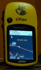
Every week I do an update to my OpenStreetMap Garmin map.  It's as much for me as for anyone else - the mapping I've been enjoying doing all year (marvelously described as "OCD gardening" elsewhere) is very satisfying when I see the new material on my GPS.  But because other people use the map too, I have to do a bit of quality control.

Each time I've finished the build, I'll do a little pan-and-scan over the whole thing, on the GPS, as an eyeball check.  Every time, I finish off by zooming right into the place where the cursor has ended up, and thinking about the points and place names I see there.  There's something intriguing about being able, if I want, to just click "go!" and be routed there, right now.

This week, it's the Amnesty Cafe in Galway.  I wonder what their cakes are like?
andygates: (Default)
The little one, that is. After last week's Tour of Britain fun was done, I went up and walked the Cadbury Castle site with my GPS, then put the detail into OpenStreetMap using the embankment tag. It just so happens there's an OSM layer for Google Earth. How did the walk match up with the aerial photo?

Cadbury Castle OSM / Google Earth overlay (by andygates)

Pretty darn well, I'd say.  I have an awful urge to flit from ancient site to ancient site now.  Where's my gazetteer? 
andygates: (Default)
Just thinking aloud here. My OSM Garmin maps have ugly coastlines that are useless for detail stuff. Those coastlines are blockwise shapes that come with both the basemap and the SMC's topo.  Mkgmap only generates a line for natural=coastline ways, with 'the sea is on the right, land on the left'  as a usage convention.  So to get perfect coastlines I need to:
  1. Be opaque so the basemap doesn't show through.
  2. Replace the SMC contours with some that don't have a coastline on them.  That means using Groundtruth to get SRTM (or the new high-res) dataset then building a set of transparent IMG tiles from it for subsequent use (doing it this way means you can turn off the contours as a layer).
  3. Sort out Mkgmap's coastline render.  Ah.  Right. 
    1. A cheesy way around it would be to style a line that's hashed on one side, but that's not attractive.  We want an expanse of blue for the briny.  Plus, to work the line would have to be thick and that'd break badly when exposed to the fractal horror that is real coast.
    2. Not quite so cheesy would be to do a special shapefile export at multiple zoom levels from the OSM planet file, which is how the main slippymap does it; it runs once a month or so to catch updates in what is a very slowly-updating data type.  You could then incorporate that as an IMG using Sendmap.
    3. Mkgmap would ideally do a coastline processing run at some point early in its run (the land/sea divide being a fundamental type of landuse, after all)).  Land should be left alone.  Sea should be painted in.  Sea is limited to 250-point polygons by the Garmin format.  So we could start at the beginning of each natural=coastline way, scrobble along it for N points, then come away from the coast by a distance and scrobble back, effectively painting a fat blue worm around the coast, the same way a child would colour it in.  That brings two new issues:
      1. The 'by a distance' value (the worm's fatness) cannot cross another coastline way.  Ideally it would be, say, 55% of the distance, so that the opposing fat worm and it overlapped nicely.
      2. We need to then block in the gaps between worms, ad infinitum to the edge of the map.  But the worms are not real objects!  Aiee...
    4. Perhaps slice the map into strips.  Each strip is a rectangle with one complicated side, so 240-odd points plus the regular corners.  From the edge of the map, scan along coastline ... and get caught out with islands and hooky bits creating shadows.  No, that's not going to work.
    5. What less human approaches might work?
I can see why this has persisted so long.  My head hurts.

In the short term, though, I can recompile the topo so it doesn't include coast.  That'll help.

Update: actually, the shaded-on-one-side coastline works better than I thought it would:


coast1 (by andygates)
andygates: (Default)
Really, mapping isn't supposed to be addictive, it's supposed to be a chore.  There's no good reason why I should cheerfully scurry down overgrown trails, muttering and making sure that every single way is traced -- especially not in a salt marsh!  Okay, so it was a lovely evening, but instead of going training I ended up on a spit of sand in the middle of an estuary, covered in fluffy pollen, watching a young fox chase butterflies while wondering if I'd be able to get all the paths before the light went. 

You do find cool stuff, though.  Stunning views like today's.  Kinky little link-ups that I'd never have found if I wasn't just finding every way (algorithm: keep turning left. Yup, I run Logo).  All manner of random beasties and secret spots where the mushrooms are already fruiting.

The simple joy of discovery, even if it's been discovered plenty of times already.  I'm already looking forward to doing Tignes in a quiet few hours...
andygates: (Default)
Check this out: automatic fitting and projection of maps to landscape photos.  Very clever, very pretty.
andygates: (Default)
While riding on Friday night, I'm fairly sure I saw a SQL injection attack as a street name in my Openstreetmap GPS.  I was pretty strung out, in overnight ride stylee, and will need to go back and check the logs, but it definitely wasn't a real street name.  Real street names don't have backslashes!
andygates: (Default)
One of those weird-but-chilling moments, brought up from a fairly trivial technical question out in OpenStreetMap land.  "How do you tag a road that's one-way for Palestinians, but two-way for Israelis?" 

Way to institutionalize discrimination, there, folks. 

The answer is to treat each lane as a separate way, and negotiate some new restriction tags (much like hgv=no or bicycle=yes, the tag palestinian=no is technically and logically sound, just morally foul), in the meantime using verbose road naming.  Multiple ways present fuss at junctions, as bike lane mappers find regularly, but it works.

andygates: (Default)
Compare the OpenStreetMap map of Tignes with the speciality render OpenPisteMap.  Yup, nobody cool gives a good goddamn about the streets in a snow resort town. 

And why would they with regular free shuttle-buses and a compact shopping and bar area?  If we go again, I'm going to have to nerd out avec GPS.

andygates: (Default)
What's the difference between OSM on Garmin and Garmin City Navigator?

(I was asked this on a bike forum, and it's worth putting out wider)

OpenStreetMap is a wiki world map, so it's like Wikipedia: lots of detail in some places, and some gaps.  In general all the useful roads are in place - I've no trouble navigating around using it - but villages may be just dots. 

When some enterprising mapper decides to put the detail in, it can be better than the commercial maps: fresh areas are really fresh, and micro-mapping nerds (the equivalent of fanboys writing about Firefly on wikipedia) get buckets of detail in.  OSM in the UK and Germany is very comprehensive; Northern Europe is pretty good, so's the US. 

OSM's coverage of third-world locations is often better than any commercial map, because there's no money in updating a map of Kinshasa, but a UN intern with a hiking GPS can lay out the groundwork in a weekend.  There was a recent project to update Gaza, which was ever so cool. 

City Navigator is very strong on POI - points of interest, pubs and cinemas and so on.  OSM's POI are a bit variable.  POI weren't the original aim of the project, which has grown way outside its original scope (it was never intended to be on Garmins!).  Now, people are filling in POI and it's fleshing out well. 

Routing on OSM is fairly new.  Sometimes people have mapped an area a bit weirdly, and the routing can go a little mental, but mappers are tidying those up now that routing is maturing.  City Navigator's routing is good, but like all GPS routing, if you set it wrong on the device, you can end up in a pond.

One thing I really like is that updates to OSM get included quickly.  The cost of updating Garmin maps means that I know plenty of people still using a map several years old; OSM is as fresh as last night's edits.  (User edits hit the live map in a couple of hours; most extracts like the ones I use are once-per-day). 

As for my take on the map, it's a heavyweight, busy one aimed at cyclists and hikers: it's got contour lines, and trail/cyclepath obstructions like fords and gates, and cafes and convenience stores and pharmacies and bike shops, for example.  I've added highway points like crossings, lights and mini-roundabouts for walking navigation.  Bus stops and postboxes are also included, mostly because if they show up, you know someone has obsessively covered the area in detail ;)

My map is pretty cluttered and busy at some zoom levels.  300m in a city is ugly.  It's best at 80-120m and 1-3km, which I think are best for walking and riding.  Works fine elsewhere, but it's got lots of thick friendly lines.

In summary:  Garmin City Navigator has proven routing and great POI, but costs a lot and updates infrequently.  OSM has routing, rapid updates, contour lines, and is free, but has the inherent limitations of a wiki in coverage. 

The limitations of a wiki are also its strengths: if you like, you can contribute to the project.  If you like, you can even do your own homebrew Garmin map too, and there are a number of other Garmin UK versions freely available.  Mapping your local patch is addictive!

Purdy maps

Mar. 16th, 2009 03:10 pm
andygates: (Default)
Yes, it's trumpet-blowing but I like how they're coming out :)
This stylesheet is going to use UK road colour standards, bring in some highway navigation points (lights, crossings, roundabouts), pick up some extra POI (bike shops, convenience stores) and especially, it should have cafés and pubs on a wider zoom for targetting en velo.  Need to work out how to blaze some routes where they have NCN, etc references.

Lovingly hand-blown icon, that "i" - pixelwise icon scrimshaw, which is preposterously retro but when you've about 16x16 to play with, you just can't scale it. 

Scarily addictive, this - like discovering desktop publishing and going mad with the fonts, it's an effort to keep restrained.  No magenta skulls for graveyards!

Now, does anyone know how to change the base colours?

andygates: (Default)
Custom icon on Garmin (by andygates)I've worked out how to do custom icons on the Garmin.

This is, of course, for bike shops, which OpenStreetMap defaults to either nothing, or the boring shopping-basket icon. Custom icons are full of fail, because with 32x32 and a full alpha channel to play with, I can see myself wasting huge swathes of time getting my maps just so.

How-to:  It's a two-stage thing.  First, define a mkgmap style for the tags you want to use.  That means that the map objects get marked with the correct Garmin TypeID.  Shops are 2e, with the higher numbers unused, so 2e10 is bike shops (tag: shop=bicycle) to me.

Second, build a custom Typ-file (a Garmin binary that holds the colours and graphics) using the online editor.  The neat thing here is that if you define very little, the rest will appear as defaults, so it's quite hard to break it.  It's very easy to make something hideously gaudy, mind!  The typ-file styles all elements - land, ways and points - so at some point I'll start painting buildings and I'll colour the roads to match UK road signs, which is intuitively right to me.

andygates: (Default)
It's a little thing, like the Beautiful Spreadsheet, but I do like my time-saving tools to be very, very time-saving.  So forgive a little 'squee' for finally polishing the OpenStreetMap Garmin script to an apogee of glittering sloth:
  1. It downloads that day's fresh UK and Ireland data from the world map (20-30 minutes).
  2. It does all the conversions needed to make routable maps (40 - 50 minutes).
  3. It makes routable maps in a couple of different visual styles, combining the streetmaps with public-domain topological data (20 minutes).
  4. It zips, datestamps and uploads them (several hours, damned asymmetric ISP).
  5. It sends a Tweet gloating announcing the fact.
  6. It shuts the computer down for a good night's rest.
Tools: wget and wput for the file transfers; 7-zip for the vaarious compression and decompression chores; osm2mp to make routable data; mkgmap to build Garmin maps; Say to natter throughout; Twitter.pl for the zeitgeist coup de grâce, and of course the OpenStreetMap.org free wiki world map for the original data and GeoFabrik.de for hosting the daily database snapshots.

Who says you don't get anything for free?  :)

andygates: (Default)
...and this is why an open dataset and tools rock.
  1. Using the 'tagwatch' pages of the OSM wiki, pull down an OSM data file of shop=bicycle.
  2. Load it into the map editor, JOSM, and trim off anything outside UK/Europe.
  3. Load that into GPSBabel and convert from OSM to GPX.
  4. Use your POI loader to stuff the data onto your GPS device.
That's really nifty.

andygates: (Default)
I've been playing again.  OpenStreetMap user ComputerTeddy runs regular updates of the OSM data into Garmin-friendly tiles.  I've taken his  fresh 15th January 02009 tiles for UK and Ireland, combined them with the SMC's UK topological map, and put them all into a Garmin-installable streets-and-topo map.

You can download it here: http://www.ravenfamily.org/andyg/maps

Cut for geeky details... )
andygates: (Default)
My fad of the moment, this: OpenStreetMap is a wiki world map.  Why?  Well, the regular world maps are fine but they're copyright material, so there are limits and costs on what you can do with 'em, and they update once a yawnellium.  OSM lets you edit it yourself and do whatever you like with the data.  The online editor is too simple to be fun but the downloadable 'JOSM' editor's a breeze.  You upload GPS traces then draw over them and add POI and metadata as you go.  The editable map is re-rendered midweek so those weekend geo-nerding trips' results are all live by next weekend.

The main online map is kinda dull, but the possibilities are much more entertaining.  Because there are cycle route categories, for example, someone's written a render that highlights cycle routes and minor roads, dims trunk roads, and has bike parking, bike shops and bike hire POI - and made it a Garmin file.  Another chap has piped it as a layer over Blue Marble. 

Of course there arise the usual wiki questions of reliability, completeness and partisan editing.  What if someone goofed?  What if your town isn't there (Crediton mostly isn't, though someone is filling it in now - must have got a GPS for Christmas)?  And what if you've got Aaron123 and Ahmed2009 both editing the hell out of Gaza?  Well, those are all valid questions, but the stunning success of good wiki projects suggests that they're all soluble without too much sweat: correct errors you see; find local rambler zealots and feed them gap lists; apply the mod-stick and lock certain areas.  Right now, it's about where Wikipedia was in 2002, back when you could easily add whole sections, but even so the general coverage is very good. 

It'd make a great class project: draw the local area map as part of a whole local-geography, history-of-maps thing.

Profile

andygates: (Default)
andygates

April 2017

S M T W T F S
      1
2345678
9 101112131415
16171819202122
23242526272829
30      

Syndicate

RSS Atom

Most Popular Tags

Style Credit

Expand Cut Tags

No cut tags
Page generated Jul. 3rd, 2025 01:39 am
Powered by Dreamwidth Studios