Purdy maps

Mar. 16th, 2009 03:10 pm
andygates: (Default)
Yes, it's trumpet-blowing but I like how they're coming out :)

This stylesheet is going to use UK road colour standards, bring in some highway navigation points (lights, crossings, roundabouts), pick up some extra POI (bike shops, convenience stores) and especially, it should have cafés and pubs on a wider zoom for targetting en velo.  Need to work out how to blaze some routes where they have NCN, etc references.

Lovingly hand-blown icon, that "i" - pixelwise icon scrimshaw, which is preposterously retro but when you've about 16x16 to play with, you just can't scale it. 

Scarily addictive, this - like discovering desktop publishing and going mad with the fonts, it's an effort to keep restrained.  No magenta skulls for graveyards!

Now, does anyone know how to change the base colours?

andygates: (Default)
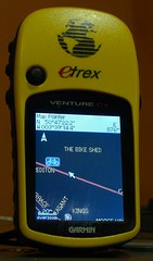
Custom icon on Garmin (by andygates)I've worked out how to do custom icons on the Garmin.

This is, of course, for bike shops, which OpenStreetMap defaults to either nothing, or the boring shopping-basket icon. Custom icons are full of fail, because with 32x32 and a full alpha channel to play with, I can see myself wasting huge swathes of time getting my maps just so.

How-to:  It's a two-stage thing.  First, define a mkgmap style for the tags you want to use.  That means that the map objects get marked with the correct Garmin TypeID.  Shops are 2e, with the higher numbers unused, so 2e10 is bike shops (tag: shop=bicycle) to me.

Second, build a custom Typ-file (a Garmin binary that holds the colours and graphics) using the online editor.  The neat thing here is that if you define very little, the rest will appear as defaults, so it's quite hard to break it.  It's very easy to make something hideously gaudy, mind!  The typ-file styles all elements - land, ways and points - so at some point I'll start painting buildings and I'll colour the roads to match UK road signs, which is intuitively right to me.

andygates: (Default)
I've been playing again.  OpenStreetMap user ComputerTeddy runs regular updates of the OSM data into Garmin-friendly tiles.  I've taken his  fresh 15th January 02009 tiles for UK and Ireland, combined them with the SMC's UK topological map, and put them all into a Garmin-installable streets-and-topo map.

You can download it here: http://www.ravenfamily.org/andyg/maps

Cut for geeky details... )

Brrr!

Jan. 1st, 2009 05:45 pm
andygates: (Default)
Plan to hike across the stark majesty of the high moors in winter and what do you get?  Half-frozen in the cloudbase, 50-metre viz and hilariously turned-around at every junction.  Yay GPS.  This is South Hessary Tor, the only one I could actually see because it jumped out of the murk and said "Boo!"

South Hessary Tor NYD (by andygates)

andygates: (Default)
My fad of the moment, this: OpenStreetMap is a wiki world map.  Why?  Well, the regular world maps are fine but they're copyright material, so there are limits and costs on what you can do with 'em, and they update once a yawnellium.  OSM lets you edit it yourself and do whatever you like with the data.  The online editor is too simple to be fun but the downloadable 'JOSM' editor's a breeze.  You upload GPS traces then draw over them and add POI and metadata as you go.  The editable map is re-rendered midweek so those weekend geo-nerding trips' results are all live by next weekend.

The main online map is kinda dull, but the possibilities are much more entertaining.  Because there are cycle route categories, for example, someone's written a render that highlights cycle routes and minor roads, dims trunk roads, and has bike parking, bike shops and bike hire POI - and made it a Garmin file.  Another chap has piped it as a layer over Blue Marble. 

Of course there arise the usual wiki questions of reliability, completeness and partisan editing.  What if someone goofed?  What if your town isn't there (Crediton mostly isn't, though someone is filling it in now - must have got a GPS for Christmas)?  And what if you've got Aaron123 and Ahmed2009 both editing the hell out of Gaza?  Well, those are all valid questions, but the stunning success of good wiki projects suggests that they're all soluble without too much sweat: correct errors you see; find local rambler zealots and feed them gap lists; apply the mod-stick and lock certain areas.  Right now, it's about where Wikipedia was in 2002, back when you could easily add whole sections, but even so the general coverage is very good. 

It'd make a great class project: draw the local area map as part of a whole local-geography, history-of-maps thing.
andygates: (hellboy)

Profile

andygates: (Default)
andygates

April 2017

S M T W T F S
      1
2345678
9 101112131415
16171819202122
23242526272829
30      

Syndicate

RSS Atom

Most Popular Tags

Style Credit

Expand Cut Tags

No cut tags
Page generated Jul. 3rd, 2025 07:22 am
Powered by Dreamwidth Studios